Old Sawtry
The modern A1M (completed in 1998) cuts through the site of old Sawtry. Excavations during the construction of the A1 identified a Roman settlement just below Tort Hill. Some Roman and 13th-c pottery has been found here, including 3rd century Nene Valley wear. Tracing the direct line of Ermine Street along the B1043 (Great North Road), suggests that this short stretch of road, which now bends slightly eastwards towards the site of St Andrews church (demolished in 1879), may have originally run closer to the path of the A1M at this point.
")
North West area of Sawtry
indicating the route of Ermine Street (B1043 - Great North Road).

Sawtry Old School House © TAB
The historic core of the village is defined by historic buildings along High Street, around the Green and along the top end of Green End Road. This area is designated as a Conservation Area and retains a strong village character. The village has expanded greatly over the years since the war. Large residential estates dominate the western and southern parts. School playing fields in the centre and uplands to the south west provide some green open spaces. Small industrial estates are present at the northern end of the village and on the eastern side of the B1043. The village has a small supermarket, post office, surgery, dentist, chemist, several newsagents and other small shops. There are also extensive areas of ancient woodlands in the vicinity of the village.
Archer's Wood
Archer’s Wood, located to the south of Sawtry, is believed to include remnants of original British wild wood and contains mainly ash, field maple and native oak. True to its name, the wood was notoriously a sanctuary for highwaymen during medieval times. The edge of the woods were cut back to within bow shot of Ermine Street to protect travellers, thus reducing its size.
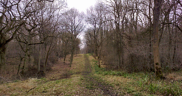
The wood is mainly flat with easy access and a basic figure-of-eight network of paths, so it's ideal for gentle walks. Pathways can be muddy when wet so you will need to wear suitable footwear and be sure to look out for foxes, woodpeckers and nuthatches. A ditch and bank in the field to the north east is another scheduled ancient monument where a 14th-c Cistercian monastic grange once stood. The grange was excavated in 1979, revealing the remains of wattle and daub buildings, bread ovens and metal working hearths.
Aversley Wood
Another ancient woodland, located just 500 metres west of Sawtry, is Aversley Wood. Perched on a slight rise, it provides stunning views of the fenlands and also across to Archer's Wood. The site is a SSSI and contains a mixture of native broad leafed and fur trees and is ideal for a peaceful ramble if you are in the area. The woods are packed with wildlife and provide some of the best bluebell displays in the county in May.
Sawtry Woodland Walk
A four mile (6 km) circular walk through both woods can easily be achieved, starting from the free car park at the start of St Judith's Lane (just off Green End Road, next to Sawtry playing fields).
Walk up hill from the car park, passing the allotments on the left. Cross the style and walk over the rise to Aversley Wood. There are several pathways through the wood. Continue south-west until you exit the woods at the old Bullock trackway, at the top of the next rise. Turn left and follow the old trackway down the slope back to St Judith's Lane. Turn left and follow the lane down-hill to the entrance to Archer’s Wood. Once you have walked around the wood here, turn left (back into St Judith's Lane, opposite the entrance to the wood) and follow the lane back to the car park.
Sawtry Abbey
The Cistercian Abbey of Saint Mary, founded in 1147 by Simon de St. Liz (Earl of Northampton), once lay on the south-east edge of Sawtry fen, as far removed as was practicable from the general hubbub and traffic of Ermine Street. The abbey took 91 years to construct, built of local stone from Barnack. The site was utterly destroyed after the Dissolution of the Monasteries in 1536-1540. The site was excavated in the mid 19th-c, when the foundations of a church, gate-house with a bell tower were identified.

The site of the Abandoned Abbey at Sawtry © TAB
Little is really known of the history of the Abbey, although it was famed in local rhyme for its generosity in alms giving. However, the abbey was notably a place of some importance because of its close proximity to Ermine Street (Great North Road), which resulted in a number of Royal visitors staying there on journeys between North and South. Several royal documents were dated there between 1235 and 1334 and Edward II is recorded as staying there in 1315. Henry VIII's divorced Queen Catherine, who died in 1536 whilst imprisoned in nearby Kimbolton Castle, was carried in a funeral procession to rest at Sawtry Abbey overnight on its way to the Cathedral at Peterborough Abbey, where her tomb can still be seen to this day.
Pre-Roman Sawtry
Late Iron Age occupation has been recorded at Tort Hill, which ceased after construction of Ermine Street. During the 1st century a roadside settlement developed, which continued until the middle of the fourth century. There is no evidence for post-Roman occupation in this area.
Between 2004 and 2008, a series of excavations were carried out to the east of Sawtry, on the far side of Ermine Street around Black Horse Farm. These revealed a large complex settlement spanning from the Iron Age to Romano-British periods. The initial digs identified at least five round houses, inside a large circular ditch enclosure. During a later remodelling of the site, a larger roundhouse was constructed replacing two earlier ones. This larger roundhouse was possibly a building of higher status and was partially built of stone. At a later stage, a timber beamed rectangular structure replaced the large roundhouse. The final occupational phase of the site dates from the early Romano-British period (mid 1st to mid 2nd century AD). There is some evidence of flooding during the latter part of occupation, possibly by inundation from the nearby fen, which may have led to the eventual abandonment of the site.
Further evidence of Late Iron Age enclosures were found during the laying of the Sawtry to Sapley Anglia Water Pipeline. Showing a possible settlement adjacent to Ermine Street (South of Monk’s Wood Farm) where Roman crop marks had previously been identified.
References
- Iron Age settlement at Black Horse Farm, Sawtry, Cambridgeshire Archaeological Solutions Ltd
- A Glimpse into Sawtry's Past - by CARESCO
- Fieldwork in Cambridgeshire 2008 Cambridge Antiquarian Society
- A History of the County of Huntingdon British History Online
- Ordnance Survey Map - Explorer 227
Sawtry Cycle Route
A circular cycle route (Cycle Ride 14) starts at Sawtry and travels through Stilton, Caldecote, Glatton, Conington and Holme. Distance: 21m (16km). A plan of the route can be obtained from Peterborough or Huntingdon Tourist Information Centres.
Previous Page << Sawtry IntroductionEast of England